Category: ENSAPL (page 1 of 2)

SOUTH DIVE, Metropolitan Swimming Pool

Why | To design a metropolitan swimming-pool in a neglected area
What | Analysis + local benchmarking + programme + design + construction details
Where | Lille, France (1,4 ha)
With | ENSAPL
Who | For  ENSAPL

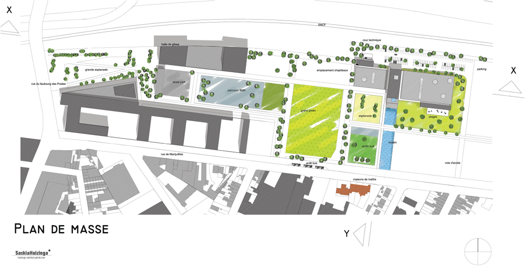
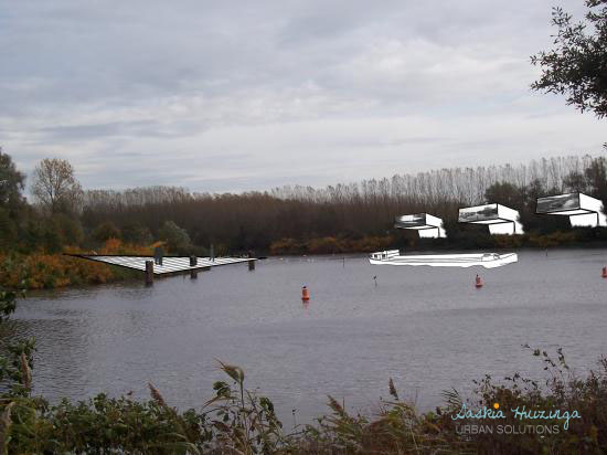
Lille-Sud is a district in complete regeneration. It has lots of social housing and is separated from the rest of Lille by rail and belt ways. A new park is developing on a brownfield along those ways around the topic of sports.

The goal of the project is to design a new metropolitan swimming-pool that will also give a new image to the now neglected district.

After having analyzed the site and especially its two different scales,  I studied the current needs and the trends of the swimming-pool market and made a references booklet about the existing facilities in the metropolis to make an adapted and unique programme with necessary functions and special areas.

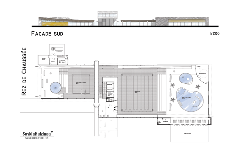
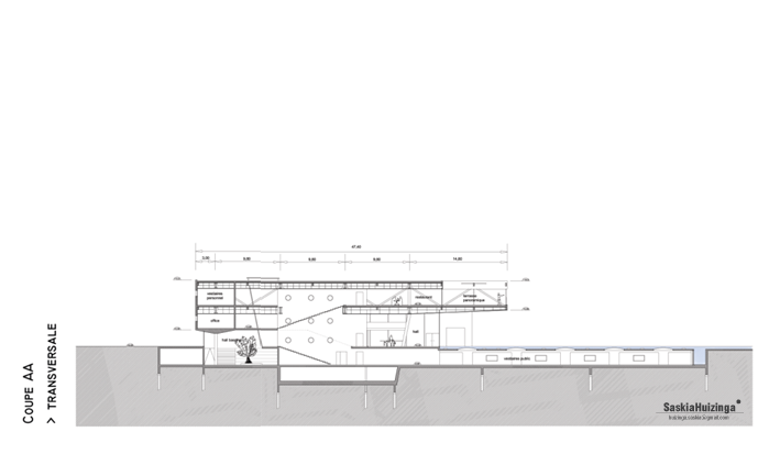
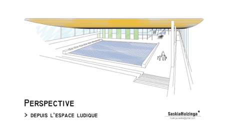
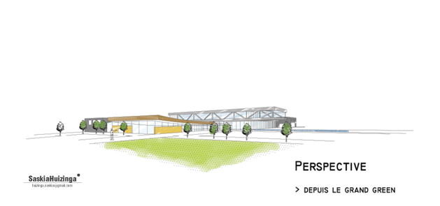
The metaphor of a diving board has been chosen to make a shift between the scale and direction of the ways and the ones of the district as the cantilever also expresses the fact that there is a special diving pool. That upper block also contains a panoramic restaurant overlooking the sports park. That attracts more than swimmers and divers. The minimalist architecture recall the one of the brand new neighbour skate hall.

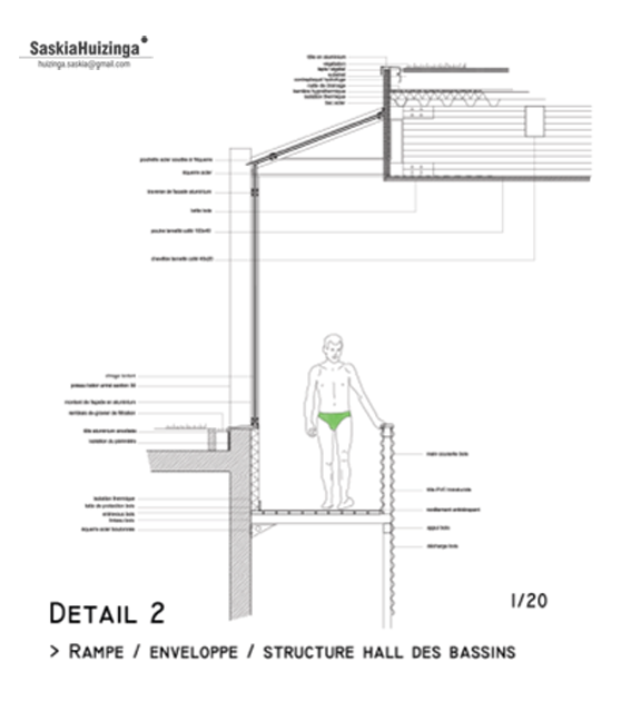
A lightning concept has been developed to make the journey of the visitor experimental. He dives in the rather dark changing rooms under the outdoor basin to then slowly reach the bright pools halls through ramps.

CREAPOLE, Redesigned Mine Centre

Why | To redevelop a post-industrial area
What | Team management + analysis + organic/phased masterplan + office modular system
Where | Wallers-Arenberg, France
With |  ENSAPL
Who | For city of Wallers-Arenberg

After the exploration of the whole Regional Natural Park Scarpe-Escaut, we focused on Wallers-Arenberg mining site.

It stretches on 14 hectares and is made of a pit where a high slag heap stood, about 10 listed buildings of which 3 are head frames, a flat slag heap, subsidence basins and a former railway used to evacuate coal. It is located between a mining village and a national forest, not far from famous race “Paris-Roubaix”.

We took down and analyzed important components: landscape, historical review, population, infrastructures, scales, private and public stakeholders on the site. That is how we have drawn 3 poles to develop: mine memory, sports and leisure, companies development. We called it “Créapole”.

The pit becomes a transitional garden between the forest and the town. An interior street leads off to the young firms that can develop according to the need (offices/workshops modules). The reception of the Natural Park, the head office of the community of communes, a swimming-pool and a memory pole revolve around a designed square.

The workplace modules are built upon firms’ request. Around a sanitary hard newel, partitions create rooms. The modules can be combined to create rooms from different sized according companies’ needs.

WATER HIGHLIGHTS, Valorized Park

Why | To valorise a regional nature parc
What | Team management + analysis + strategy + visualisations of projects
Where | PNR Scarpe-Escaut, France
With |  ENSAPL
Who | For PNR Scarpe-Escaut

With the aim of creating a new mental map with all the qualities of the park territory, a complete analysis has been undertaken. There are 5 themes: the original landscape, the mining traces, the infrastructures, the activities and finally the housing.

After analyzing the subtle interlacing of the communication routes, our group reached the following issue: the water presence is barely visible and enjoyable even though water is the main feature of that Regional Natural Park (PNR).

So different strategies are suggested to highlight those qualities: jetties, pollard willows alignment, aquatic gardens with gangplanks, architectural heritage renovation (bridges, locks…), walk paths along the banks, structures for the navigation…

A project of marina at the PNR scale is developed at the junction of two canals. It makes it possible for the inhabitants to discover their region by navigating and also to offer a rest area to many sailors crossing the region (Dutch, Belgians and Germans).

From there, an aquatic route brings the visitors in the heart of the lands and until hiking roads. People walks and discovers successively marina, ornithological basin, small boats pond, quays with restaurants in town centre, fishing basin and finally, a nautical base already existing, created on a former mining site.

« Older posts

© 2024 Saskia Huizinga

Theme by Anders NorénUp ↑